Author Archives: Brianna Caszatt

Personal Blog: Commons Site (and Clever Title) TK

Inspired by our class and group discussions in last Thursday, we decided our project would benefit from having a companion WordPress site on the Commons. We already have a Commons group where we share all of our files, keep track of deliverables, and conduct most of our conversations via forum threads. Creating the Commons group was fairly simple, and I only had to check a box to create the companion site: So. Simple.

Yes, and no. A weekend and various additional hours later and our site exists, but I’m also not quite happy with it. In our meeting this evening, my group was very supportive of what is built so far. And I know I shouldn’t be quite so hard on myself as this is my first time ever building a website. And yet…

I think the content we’re building on our Commons site is very solid already. We’re envisioning this site as a space where we can better address our audiences’ pedagogical needs–going more in depth about the making of/behind the scenes of Mapping Cemeteries and explaining our thought processes and decisions along the way. Indeed, we’re finding we can reuse much of what we’ve already contributed in our class blog (aside: this post will definitely be making its way into our Commons site blog, and in posting on our class blog I will be experimenting with my ability to simultaneously post there too, rather than posting twice and backdating–see my comment to see if it worked!).

We’ve engaged comments on our blog page, and we’ve engaged Hypothesis collaborative annotating on every page of our site. We also have a “What We’re Reading” page where we are highlighting articles we are finding particularly influential in our research, which we are linking to via Hypothesis–so we can show our audience our own notes and also encourage them to contribute their own annotations. Our current issue is that an article we’ve found fundamental to our understanding of necropolitics isn’t open access. As a student at the Graduate Center, we have access to the PDF of the article via Project Muse. Hypothesis has a suggested tool where I can drop any PDF and make it accessible for public annotating, and I’ve successfully done so, but if we make the link live, then I think we’re violating copyright. We need to discuss the ethics of this with a librarian. Update to come. So for now our Commons site remains private. But I will share it with the class when it’s ready.

Mapping Cemeteries: Site Preview

We (namely, Nadia) are building our project in GitHub Pages, and have yet to publish the site so far. But here are some screenshots to show everyone of the direction we’re heading in.

Splash Page

The first page you see is a map of New York City. We will have an interactive pin for each of our locations. Locations may be a combination of actual and imagined geographical coordinates. Some of what we wish to map–in this phase and beyond–may be unmappable. For example, exact locations are no longer known, we want to be respectful and not draw unwanted attention to closed sacred spaces, or the spaces simply resist the limits imposed by a map–or some combination thereof. Hovering over a pin will show you an image and let you click through to the location’s page.


Screenshot from the wireframe of the Mapping Cemeteries project for the "Splash" (or Mapping) page.

The “Splash” page is a map of NYC and has interactive pins for each cemetery.

Timeline Page

We are experimenting with both horizontal and vertical timelines. The horizontal timeline will help position our research and locations within the broader context of New York City history. It will include dates and very short blurbs pertaining to infrastructural milestones (e.g., Croton Aqueduct), legislation (e.g., burial bans), epidemics (e.g., yellow fever), and times of significant population growth (e.g., key Census count years). The vertical timeline will focus on our specific locations. We envision it as a conversation between our locations/us, tied to specific years, that explores the connections we discover between them. Each of our locations will be represented by a category tag and gravatar. Clicking “Read More” from a pin in the horizontal timeline will direct the user to the full location page.

Screenshot from the wireframe of the Mapping Cemeteries project for the Timeline page.

The timeline page has a horizontal interactive that gives broad historical information about the NYC deathscape. The vertical contains our discreet scholarship. Both are interactive.

Location Page

Each location will have its own page. These pages will feature a combination of historical and present-day images (when possible), and the content will take essay form as we explore each location in depth.

Screenshot from the wireframe of the Mapping Cemeteries project for the War Memorial Cemetery page.

Each of our cemeteries will have their own page. The bulk of our scholarship will be contained within these five pages.

About Page

Our about page will highlight key information about the project and about us, as well as ways to contact us.

Screenshot from the wireframe of the Mapping Cemeteries project for the "About" page.

The “About” page has information about the project and its participants.

Commons Companion Site

We are very intrigued by Bret’s suggestion to build a site on the Commons after our discussions last night–as a full group and in our breakout room. We are already using a Commons group as the primary means of communicating and sharing files. We (namely Bri) will start building a public-facing Commons site tied to our private group page. We envision this site as a “behind the scenes” or “making of” view of the project. We can use much of the content we’ve already blogged for class. We can also include a more in-depth analysis of our philosophical approach and fully address blockers we encounter while building the project. We will enable comments on our blog posts, and we will also provide a “What We’re Reading” type page with links to articles shared via Hypothesis to engage our audience in building a collective understanding of key articles shaping our theories. We may even enable Hypothesis across the whole site so our audience could engage with any content they find interesting or have more questions about. As such this site would fulfill much toward our pedagogical aims and also serve as a means of audience outreach beyond the limited scope of social media platforms. We will link to the Commons site from our project site About page, and our Commons site will link to the project on GitHub pages. Depending on the social media post, we can drive traffic to one or both of these sites.

Social Media Links

Here are links to three of our social media accounts. Please follow us.

Instagram: https://www.instagram.com/mappingcemeteries/

Facebook: https://www.facebook.com/mappingcemeteriesnyc

TikTok: https://www.tiktok.com/@mappingcemeteries?lang=en


*posted by Lisa, Nadia, Asma, lane, and Bri.*

Personal Blog: Research Mode Activated

This is the first week I think I’ve felt more excited than overwhelmed by the project. I made time to get lost in research, and I learned so many fascinating (read: horrible) things.

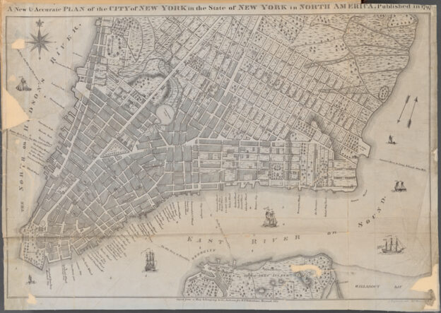
After class last week, I decided to poke around the New York Public Library’s digital archives and see what kind of public domain images they have that I could use of City Hall, City Hall Park, and the First Almshouse. And there are many, so that was very reassuring. I found images of Bridewell Prison, which seems to have a pretty brutal reputation. And I also found this image of a public execution (it is not public domain and I would not to replicate an image of an execution on our site even if it were), which was tagged as “Conspiracy of 1741.” So I had to dig further (see here and here). In short, after a string of fires, the wealthy elite and government were afraid of a slave uprising, the ties between the slave community and the multiracial working class community, and also anyone with Spanish and/or Catholic ties as England was at war with Spain. As a result, there were mass executions (both hangings and burnings) and exiles (with many Black people sold into slavery in the Caribbean and white “conspirators” exiled from the colony).

All in all, my research is leading me toward an understanding of the space that is now City Hall and City Hall Park (and was previously the Commons) as a place imbued with a whole lot of death. The seat of power built upon a space so preoccupied with punishing bodies; this inheritance seems more than symbolic.

For the horizontal timeline aspect of our project, which will help put our cemetery and memorial locations into the context of the wider history of the city, I focused my research on different outbreaks–yellow fever, cholera, typhoid, polio, smallpox, influenza, AIDS. Of particular interest, I learned more about “Typhoid Mary.” I realize I knew of her, but knew nothing really about her: a young immigrant woman who worked in the kitchens of several wealthy families on Long Island, with the unfortunate ability to carry typhoid and infect people without ever getting sick herself. She was by no means the first person to do this, nor the worst asymptomatic “offender.” But given her status in comparison with those who she inadvertently infected, she was branded a pariah and forced to spend the last 20+ years of her life in isolation on North Brother Island. And I found similarities to the person wrongly accused of being “patient zero” in the AIDS crisis, and I dare say there are parallels with the upswing in anti-Asian hate crimes being committed now during COVID. Illness being treated as the moral failure of certain individuals.

I really was excited this week, though typing all of this up in my blog post is getting me down. We shall see where my research leads me this week.

Map of Lower Manhattan from 1797

Mapping Cemeteries: Outreach and Publicity Plan

Our team is prioritizing pedagogy and the overall reproducibility of Mapping Cemeteries in our Outreach and Publicity Plan. While several social media platforms and web tools provide wide opportunities for distribution, not all–or even most–are conducive to teaching the Digital Humanities (DH) skills and topic of Mapping Cemeteries. 

We understand that our primary and secondary audiences value research, user design, user experience, and project design according to our analysis of their DH backgrounds and interests.  Based on this, we determined a six-week campaign across Instagram, Facebook, SoundCloud, and TikTok were the best options for the priorities of our audience and reproducibility of Mapping Cemeteries following our review of popular and obscure digital platforms and tools. Outlined below are key areas of outreach that include milestones and protocols to be executed during our intended window of interaction with our audience.

Staff Responsible

lane v., Outreach Lead

Asma N., Audiovisual Modulation Lead, Outreach Support

Platforms

  • Instagram 
  • Facebook
  • SoundCloud
  • TikTok  

Timeline

Our Outreach team will run a six-week campaign on the reproducibility and awareness of Mapping Cemeteries’ humanistic investigations. The timeline for outreach was designed around the time constraints of the Spring 2021 semester and the time required to execute phase 1 during this 13-15 week window. The six-week window is imagined as an opportunity for a specific and targeted approach to our outreach milestones. 

Protocol

  • Accessibility: The entire time will have access to all platforms, although Asma will be taking the lead on SoundCloud and Facebook content. Both login and passwords for the accounts will be stored in a team document.
  • Responses: Anyone on the team can respond to comments or converse in comment sections, but lane will take primary responsibility for ensuring comments are responded to within 24 hours of the comment being posted. If a comment pertains to a subject that another team member has specific knowledge or insight in, they may be requested to aid in the response.  
  • Troll Comments: With any social media presence, there is always a chance of being targeted by trolls or bots. If an inappropriate comment that has no relevance to the project is left under one of our posts, it will be flagged and removed by one of the team members.  
  • Tone: To best appeal to our intended audience of classmates and fellow academics, our social media presence will take a pedagogical approach with its posts. We do want to keep in mind the seriousness of our project’s subject matter, so the overall tone of our social media presence will be an intentional balance of educational and levitous.

Instagram and Facebook

For Instagram and Facebook we are focused on six weeks of posts starting on Week 7 of class (Spring Break):

  • At least one Instagram post with photos and relevant information on each cemetery our project is focusing on:  
    • a historical cemetery that still exists as such 
    • a cemetery that was established/other 
    • a cemetery that was repurposed as a public park 
    • a cemetery that was repurposed and later rediscovered and exists again as such 
    • a war memorial 
  • At least one post advertising each of the three episodes of our project’s podcast 
  • Other posts may include TikTok videos, excerpts from articles, or other relevant information intended to encourage interaction or draw the attention of our audience.

Audio Roundtable, SoundCloud  

Mapping Cemeteries will produce a limited, three-part audio series on phase 1 of the project hosted on SoundCloud. The first episode will introduce the team of DHers working on Mapping Cemeteries; episode two will introduce each of the five necropolitical investigations of Mapping Cemeteries; and the final episode will bring the team and listeners to an audio roundtable to disseminate Mapping Cemeteries and its overall intervention. 

Mapping Cemeteries is built with accessibility in mind; we understand access is a broad category that centers ability and learning styles alike, among other important considerations. We care about this scope, especially as it concerns the twofold pedagogical and reproduction priority of our project. We recognize audio as an opportunity to address an area of design; or to capture and playback the bits–for example a DH tip for troubleshooting–that interest our audience in another useful format for learning. We also recognize audio as an opportunity to reach our audience with known and unknown visual impairments–and varying accesses to supportive resources–through our project’s outreach. 

SoundCloud was selected as a primary hub for storing and manipulating audio data, and disseminating Mapping Cemeteries due to its reputation in audio hosting (storage), Rich Site Syndication (RSS) feed module, and playback features that do not require credentials (user registration) for our audience without an account.

Though this limited audio series will capture fragments of our project, it provides sentimental and intellectual insights to our process and relationship to our humanistic topic that would not be otherwise known, or pertinent to the key user-facing aspects of Mapping Cemeteries. 

TikTok 

The team is extremely interested in utilizing TikTok to attract the attention of our audience. Surprisingly, there is a significant amount of TikTok videos about digital humanities–most of them are in German. Before final dissemination, the goal is to post at least one to two videos discussing Mapping Cemeteries and the DH skills we’re using to build the project.  

Expected Outcomes

Our primary goal is twofold: we want to prioritize the reproduction and pedagogical elements of Mapping Cemeteries for our audience. Our expectation is that they will be able to implement at least one key DH skill outlined in our outreach content; and to reproduce an element of Mapping Cemeteries that concerns user experience and/or project design. 

For example, embedding audio is a DH skill that encompasses user experience and design and audiovisual modulation considerations. Our campaign could feature a three-part TikTok video series to teach this DH skill, informed by our Audiovisual Modulation, and User Experience and Design Leads, respectively, on how to accomplish (or to otherwise think about) this task.

  • The first video can introduce the skill, its importance, and how it can be used for a key task of our project (to reproduce).
  • Our Audiovisual Modulation Lead, Asma N., can develop instructions on how to record, edit, export, and upload an audio file to an audio source to generate an embedded code for the second video.
  • Our User Experience and Design Leads, Lisa K. and Nadia E. can show how to embed the code on the backend of a website, or platform, relevant to Mapping Cemeteries to conclude the series.

Our Outreach Team and Lead, lane v., will ultimately review the content (with project management input) and modify the pedagogy for each task in an accessible and creative manner for our audience.

If our audience can learn one of our DH skills, the hope is for them to then implement it–or conceptualize how–to reproduce an element of our project in one of the aforementioned topic areas (user experience, project design, etc.). Get the skill, use it for a task.

Measure of Effectiveness

Our Leads, Asma N. and lane v. will develop a survey to measure the execution of our expected outcomes. We want to know if and how our audience’s interests were reflected in our overall project and how our choices facilitated our goals for expected outcomes. 

Analytics

In addition to a survey, most of our intended platforms allow for analytics, or have DH tools that compensate. For instance, Mapping Cemeteries will need to establish an Instagram/Facebook business account to access its analytic feature, Instagram Insights. An alternative is Iconosquare, a free analytics tool designed to capture engagement data from Instagram and its parent company, Facebook. This digital tool, which can be discerned as one for DH in the case of Mapping Cemeteries, offers machine-learned, generated tips on how to improve our engagement. This tool generates analytics every 30 days, which means we’ll have access to two sets of analytic data within our 6-week window, should we use it.

*Map of Manhattan from 1797; image from the New York Public Library digital archives.

*posted by lane, Asma, Nadia, Lisa, and Bri

Personal Blog: The First DMP Is the Deepest

Our deliverables these past two weeks have been very challenging to me. I really didn’t want to deliver them. But having gone through the process of creating a Work Plan and a Data Management Plan (DMP), I get it. It’s so much more fun having ideas and having your head in the clouds, but, again, I get it.

In my other class, we’ve been doing related work in reviewing other digital projects. To do so, we’ve been following a template put forth by Miriam Posner (see her video How Did They Make That), in which she asks: (1) What are the sources (or data)? (2) What did they do to them/how was the data processed? And (3) how is the project presented? I’m very glad to have watched this video before working on the DMP for this class because it helped me understand how vast a category “data” really is and to start thinking about it more expansively–beyond numbers and calculations.

Having now completed my first DMP, I have to believe future ones will be easier, or if not easier then at least feel more approachable. And I am optimistic this process will change how I write a proposal in the first place. With a better sense of the data I want/am able to collect, I think I will be able to start with stronger research questions.

It was also challenging thinking about how our group data will be stored and maintained–servers seem so far away and their capacity limitless. But I’m learning this is very far from true. So how long will our data be stored? We wrote 3 to 5 years, but in my heart I wrote for-ev-er.

Gif of Officer Saying For-Ev-Er

Mapping Cemeteries: Data Management Plan

1. What are the types of data that may be produced as part of this project?

Our project will generate data specific to five cemeteries, as well as data for the timeline visuals which will combine all five cemeteries data into one. We expect to have both primary (generated by team members) and secondary data (found by team members).

  • How will data be collected (e.g., instrumentation, observation, survey, etc.)?
      • We are gathering data between February and Mid-April, 2021, based primarily on research from digital archives, journal articles, and digital sources we have access to (either through our CUNY affiliations or are freely available to the public).
  • Is it possible to regenerate the data? What are the implications for your research if the data are lost or became unusable later?
      • Yes, our data (e.g., dates and locations) will be reproducible, though we may come to slightly different conclusions about it if our supporting text is also lost.
  • What types of data will be produced?
      • images: historical images (based on licensing availability) and present-day images taken by our team members at the selected locations
      • videos: taken by our team members at the selected locations
      • audio: to increase accessibility to our text, interviews with funerary experts, and accompanying podcast documenting our process of building this project
      • text: descriptions and narratives produced by our research
      • location data: longitude and latitude of cemeteries to produce map pins
      • code: to build our website
      • metadata: for each page of our site, as well as each media item that appears on it to ensure searchability and accessibility
  • What are the tools or software you will be using to create/process/analyze/visualize the data?
      • Google sheets, Google docs, Mapbox, timeline tools like TimeLineJS or Vuetify
  • What are your access, storage, and backup strategies?
    • All primary digital assets (images, videos, and audio) will be stored on Wikimedia commons. Our main tool for storing data will be a spreadsheet. Each sheet will be filled out by all team members as they do their research.The spreadsheet will include multiple sheets:  
      • general/map
      • horizontal timeline
      • vertical timeline
      • historical cemetery
      • cemetery repurposed as park
      • cemetery war memorial
      • cemetery rediscovered
      • established/other cemetery

2. What standards will you be using for data collection, documentation, description, and metadata?

The spreadsheet will reside on Bri’s google drive, GitHub repository (in a csv format, as well as a link to the google drive in the Read.me file), team members’ local machines. Version control is built into the Google spreadsheet so we can see how/when the data is updated, and changes to our website code will also be versioned and saved within GitHub. And we are documenting our weekly contributions to the project via individual diary-like updates in our Mapping Cemeteries Commons group.

  • How do you document data collection procedures?
      • We are noting all of our data collection via our shared Google sheet. Each sheet will include the following list of columns that is subject to expand:
        • name
        • custodian
        • caption
        • description
        • data type
        • purpose
        • tag
        • source link
        • citation
        • Institution
  • How will you ensure good project and data documentation? Who is responsible for implementing this data management plan?
      • All team members are responsible for implementing this data management plan; our names will be next to all data we enter onto the sheet.
  • What directory and file naming conventions will you be using?
      • We will follow Tidy data and other best practices. All file names will use underscores (_) instead of spaces, and they will include dates to aid in version control. Information about our files will be included in a Read.me file with a data abstract, as well as a data dictionary as needed.
  • What project and data identifiers will be assigned?
      • Data will be organized via cemetery/memorial location. Historical data we include in our vertical timeline will be organized separately.
  • Will you use disciplinary or community standards for data formatting, description, interoperability, or sharing for any of the data you collect?
    • We will follow all disciplinary standards, and customize to our project needs as necessary.

3. What steps will you take to protect your or your participant’s security, privacy/confidentiality, intellectual property, or other rights? (Check current university policies for requirements.)

  • Who controls the data (e.g., PI, student, lab, University, funder), and at what level?
      • Team members control the data.
      • Google docs reside under Bri’s account as she may be using this for future phases/capstone project.
  • Any special privacy or security requirements (e.g., personal data, high-security data)?
      • We will make sure to use up-to-date software and upgrade as necessary to avoid any vulnerabilities. Additionally, no personal information will be stored on our site.
  • Do you have any embargo periods to uphold?
    • No

4. If you allow others to reuse your data, how will the data be accessed and shared? What are the data sharing requirements your work is subject to (e.g., funder, journal)?

  • Who is your possible audience? Who may use the data now, or later?
      • We are planning an initial “soft launch,” so our initial primary audiences are our classmates and attendees at the GC Digital Showcase.
      • Going forward we expect our audience to include:
        • New York City historians, especially those interested in the macabre, necropolitics, and lesser-known or “forgotten” histories
        • Scholars and members of the public studying cemeteries and memory studies
        • People offering and interested in taking walking tours and practicing alternative forms of tourism
      • Bri may expand on this project for future phases and/or for her capstone project.
  • When will you publish the data and where?
      • We will share all of our data on GitHub, and media we create will be shared on Wikimedia. We will publish our data on our website, and we will also share our findings in Clio as a potential walking tour, with links back to our website.
  • What tools/software are required to access your data?
    • Users will access our data via our public-facing website, social media posts, and Clio.

5. How will the data be archived for preservation and long-term access?

  • How long should the data be retained (e.g., 3-5 years, 10-20 years, permanently)?
      • Our data will be retained for 3-5 years, at which point this DMP will be re-reviewed to determine whether longer-term access is required.
  • What file formats will you be using, or converting to? Are they sustainably accessible?
      • Our data spreadsheet will be saved in csv format, and a link to the Google docs will be included in the Read.me file stored on GitHub. Text will live in Word and Google docs, and be backed up in rich text non-proprietary formats. Images, video, and audio files will be saved as JGP or PNG, MP4, and FLAC files (or other non-proprietary format), respectively. The non-proprietary formats will live in GitHub, and both proprietary and non-proprietary formats will be stored in our Mapping Cemeteries Common group library.
  • Who will maintain my data for the long-term?
      • Bri
  • Which data archives are your data appropriate for (subject-based? institutional)?
    • Our data archives can be appropriate for New York City history, New York–related migration studies, and Digital Humanities archives

*Posted by Nadia, Lisa, Asma, lane, and Bri*

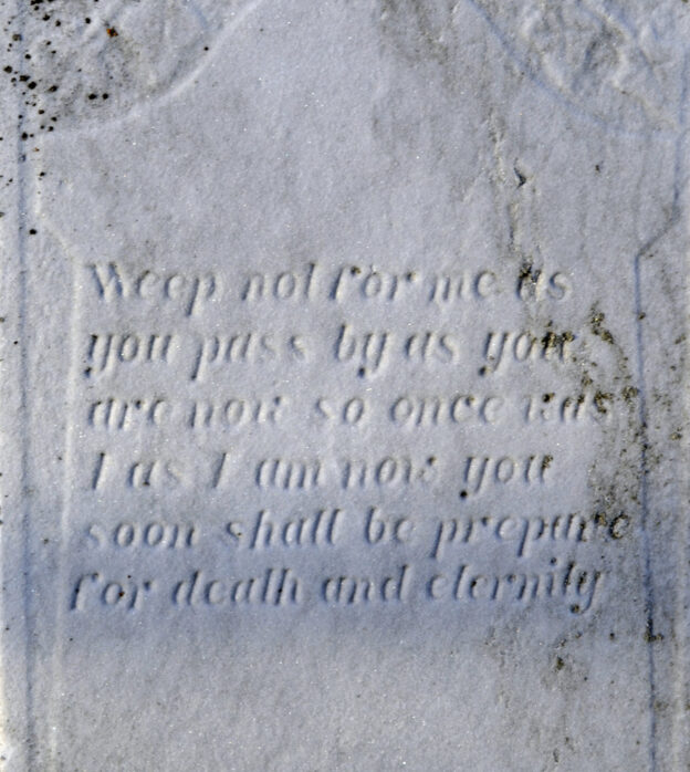
Gravestone reading "weep not for me as you pass by as you are now so once was I as I am now you soon shall be prepare for death and eternity"

Mapping Cemeteries: Working Work Plan

Refocusing Our Audience

Mapping Cemeteries is a Digital Humanities (DH) project in conversation with academic and non-academic audiences who are seeking accessible audiovisual resources that explore our complex relationships to death. With these subjects in mind, Mapping Cemeteries begins its first phase with the graduate students of the Spring 2021 Digital Humanities Praxis course with Dr. J. Bret Maney as its primary audience.

As a setting ripe with individuals who self identify as digital humanists, archivists, researchers, artists, and technologists, Mapping Cemeteries intends to engage peers and allies of the DH field, such as the Spring 2021 Praxis course, to assess its humanistic topic and technological utility. The team behind the first phase of Mapping Cemeteries wants to know how their humanistic topic and technological choices produce an overall public access to the project’s mission.

Teammates self-assigned to text analysis, research, and project management tasks conducted a small textual analysis project referred to as text mining in the literary and DH fields. This type of analysis was facilitated through text mining website, Voyant, and selected to assess, filter, and categorize the scope of data on DH skills and any relevant professional minutia of the primary audience based on their self-volunteered professional biographies from the Spring 2021 Praxis course site, DHUM 70002 Digital Humanities: Methods and Practices (Spring 2021). 

We are presenting our project to them on May 6, 2021, and we are eager to hear their feedback on the concept, design, and user experience. As we are also documenting the process of creating this project–via personal and group blog posts and a special audio project on our journey–an additional audience is students taking this class in the future, and more broadly people building digital humanities projects for the first time.

We are presenting our project to a wider Graduate Center (GC) and CUNY academic community on May 13, so attendees are also one of our primary audiences. We are considering a survey for our audiences on the general and key areas of Mapping Cemeteries to gather more feedback on the concept, design, and user experience for its current and future phases. We are approaching this presentation as a “soft launch” of our project before we share it more widely with future audiences.

Secondary audiences we want to reach with our project include other scholars studying digital memory and cemeteries. We will connect with our contacts at the GC to help us reach out to peers studying these topics at other institutions.

We also envision our project as filling a space within “forgotten” (or at least lesser known) New York City history. We will reach out to local historians as well as walking tour guides and other practitioners of alternative tourism to share our findings and our project.

Working with an End in Mind

We are exploring and collecting data from five different cemeteries/memorials, guided by our research question “Who gets to be remembered?” With this in mind, we envision Mapping Cemeteries comprising the following components:

  • A splash page (i.e. first page the user sees when they visit the main URL) with a map of New York City with five mapping points for our five locations. The user can tap any of these points, and the browser takes them to that location’s page on our site. If they tap anywhere else, the user goes to the homepage.
  • A homepage featuring both a horizontal timeline and a vertical timeline.
    • Horizontal timeline: Could be by years with some key information about NYC, like increases in population, creation of the current grid, incorporation of Brooklyn, etc. Also here can be time points for important dates for our five locations. The idea would not be to create a comprehensive timeline of NYC history, but rather to sit our research into a large context of what was happening with the land as the population expanded.
    • Vertical timeline: This could be used as a conversation between scholars (us) discussing our locations within our greater narrative.
  • Data subpages for each location that incorporate information and a fuller narrative–both narrative and audio–on our specific locations. The information here could also be used to create a Clio tour.

Key Deliverables:

We will each have decided which cemetery/memorial location we are researching by March 4.

We have already begun discussing how we will gather data and how we can store it, and we will have a revised data management plan by March 5.

We have already been discussing the many different ways we can approach outreach, including but not limited to social media platforms. We will have a revised outreach plan by March 12.

We will have a wireframe of the site constructed by March 19.

We will focus the last half of March and first half of April on organizing our data and crafting our narrative.

We will be presenting our project to our class on May 6, and then in the Digital Showcase on May 13.

*Posted by lane, Lisa, Asma, Nadia, and Bri*

Mapping Cemeteries: Bri’s Personal Bio and Contribution Statement

Brianna Caszatt hails from Michigan but has called Queens home for almost 13 years. She is a copy chief and copy editor by day and a graduate student in the MA in Digital Humanities (DH) program at the CUNY Graduate Center by night. Joining the DH community has definitely been her best pandemic decision. And buying more sweatpants. DH and sweatpants: the two best pandemic decisions by far.

Mapping Cemeteries brings together her interests (some old and some new-found) in social justice, memory studies, infrastructure, and mapping. The original idea for the project was hers, but what the project has become is so much more than she ever could have expected, and it is all thanks to the creative and collaborative energy of the entire team. As project manager, she has created a group space for everyone’s internal communications and workflow needs, she sets the meeting agendas and keeps notes during each meeting, and she makes sure blockers are addressed and goals are met. She is also responsible for the researching and data collection of a cemetery that was redeveloped and turned into a public park: City Hall Park.

“Mapping” Cemeteries: Revised Proposal

Team Members and Roles

Name: Brianna Caszatt
Primary Role: Project Manager
Secondary Role: Web Development, Mapping
Cemetery: Cemetery that was repurposed as a public park

Name: lane vineyard
Primary Role: Outreach, Social Media
Secondary Role: Design
Cemetery: Cemetery that was repurposed and later rediscovered and exists again as such

Name: Lisa
Primary Role: Design, Testing
Secondary Role: Documentation and research
Cemetery: War memorial

Name: Asma N.
Primary Role: Audio, Text Analysis
Secondary Role: Accessibility, Data Storage
Cemetery: Cemetery that was repurposed for private development

Name: Nadia El Mouldi
Primary Role: Web Development, Mapping
Secondary Role: Social Media, Outreach
Cemetery: Historical cemetery that still exists as such

Abstract

Death is an inescapable and universal part of being human, but the rituals and care provided by the living to their dead are shaped by many changing factors, including emotional, physical, financial, societal, and spiritual/religious. Cemeteries are one type of designated space created by the living for the care of the dead. War memorials, at least in part, also represent an act of care, although they are less often tied to the resting place of physical bodies. There’s an inherent tension between remembering and forgetting that happens in these places, with human memory and markers both subject to erosion. Within a city like New York, a large population confined by a definite geographical area adds to this tension. A population of this size necessarily requires the care of a larger number of dead, and it also means that the physical space allotted for the dead competes with the space allotted for the varied activities of the living.

This multisensory project aims to explore cemeteries and memorials as part of the infrastructure of the city, creating a dialogue between the city of the living and the city of the dead and the spaces in between. To facilitate this dialogue we will offer our audience multiple access points, through an interactive timeline, a scrolling narrative, audio storytelling, mapping, and other data visualizations. As a proof of concept, we are focusing on five different types of cemeteries and memorials that we feel showcase different facets of the “deathscape”–a landscape both physically represented by burial sites and monuments and notionally represented by the practices of care related to death and memorialization. These five types are as follows:

  • a historical cemetery that still exists as such
  • a cemetery that was repurposed for private development
  • a cemetery that was repurposed as a public park
  • a cemetery that was repurposed and later rediscovered and exists again as such
  • a war memorial

Building this project now and exploring our ever-evolving relationship with the deathscape both past and present holds great significance as we are still experiencing the effects of the COVID-19 pandemic and trying to understand how it is reshaping New York City.

Intended Audiences

The intended audiences for this project are scholars and the general public interested in the following:

  • cemetery studies
  • memory studies
  • necropolitics
  • urban planning
  • New York City history, especially of the forgotten or overlooked variety
  • walking tours and alternative forms of tourism

Contribution to Digital Humanities

This project will help humanities scholars, cemetery studies scholars, local historians, and all interested New Yorkers explore questions related to urban planning and sustainability and also questions about belonging, community building, and how power structures determine who “deserves” to be remembered and the impact these decisions have on living populations. The story portion of the project seeks to explore changes in the deathscape as they relate to the history of the city. For the locations that have changed, we want to explore what considerations went into repurposing the land from cemeteries to other uses. How were these proposals first brought forward, and by who? City design is a type of infrastructure, and the decisions on how to build it and how to alter it are necessarily political (Star 1999). As much as infrastructures are built to be of service to people, they also impose limitations on how we interact with and experience them (Gil 2016). How people live and die in the city affects and—perhaps more so—is affected by its landscape.

This initial phase of the project also seeks to find a basis for possible trends comparing cemeteries that were preserved and the ones that were obliterated. How does the repurposing of these spaces reflect both historical and current power structures, and what are the implications for the surrounding neighborhoods? In the case of cemeteries being converted to public parks, even if a public park could be argued to enrich the public at large, its creation likely also substantially increased the private wealth of those who bought and developed the land around it. So what ultimately is the public good—how is it defined and by whom? This project will help users explore these land use transitions and the relationships between private and public spaces further. In addition, there are repurposed cemeteries where the bodies have not been moved and the sites remain unmarked. What does this collective forgetting—in some cases purposeful—of a cemetery mean for living descendants, and how do cemeteries and memorials contribute to our understanding and claims of belonging to certain communities and specific locations?

Environmental Scan

There is much interest in cemetery studies as it relates to personal genealogies and family histories. This project will view cemeteries on a larger scale and view them in relation to and as part of the urban landscape in New York City.

The New York City Cemetery Project, created by anthropologist and museums and archives specialist Mary French, comprises archival research and a narrative snapshot for each cemetery, accompanied by historical images, newspaper clips, and snippets of maps, for approximately 350 cemeteries in the city dating from the colonial period onward. It is a tremendous project offering a wealth of knowledge on the cemeteries she has researched; however, the blog-like presentation of the information doesn’t easily allow for examination of the cemeteries in comparison with one another or an understanding of the physical spaces they occupy or occupied in relation to the city as a whole.

In her anthropology PhD dissertation for The Graduate Center, City University of New York, Elizabeth Meade sets about providing the most complete record of historical cemeteries in the five boroughs. She admits that her study is incomplete as it includes only cemeteries that were intentionally built and recognized as such. It is also based on the historical records available from the colonial period onward, and so excludes the burial activities of indigenous people pre-contact. Furthermore, as record-keeping and preservation are timely and not without significant costs, much of the available records likely skew toward cemeteries and groups of European descent with means. Her dissertation presents the maps in segments (as a limitation of the size of the page), but she also has built a website with the full map. It is an impressive undertaking to be sure, but the user experience of the deathscape is currently limited to a traditional, aerial-view map that includes little else of the city. Our project seeks to create a fuller user experience by sharing the deathscape through an interactive timeline, story scrolling, and audio narrative. As much as we may incorporate maps, we also want to challenge the ways in which we can visualize and experience the deathscape in relationship to the rest of the New York City landscape.

We’re also expanding on the projects listed above by including a war memorial as a way to further explore the notional aspects of the deathscape. Although these memorials are physically part of the landscape, they often memorialize bodies that died elsewhere; they are spaces imbued with death without having served as a home for the dead.

Work Plan

We have established a collaborators agreement, which outlines the roles we have taken on and the ways we will work together. As much as possible we are using a private group in the CUNY Academic Commons for our communications, with organized forum threads, and we’re also using the built-in calendar to keep track of major deadlines and the library to organize and archive all of our documentation. We also have a Zoom chat, our Discord channel, and email if more urgent communications are needed. In addition to using our class for synchronous working time, we are also meeting on Tuesday evenings.

We are determining what aspects of our chosen cemetery/memorial we are most excited about, and how we can create a narrative from there.

Technologies Used

We have moved away from mapping as the main objective of our visualization. We are investigating interactive timelines (e.g., Tiki-Toki and TimelineJS), as well as scrollytext and audio tools to create written and oral/aural narrative. We may still include some mapping component (e.g., Mapbox or StoryMapJS), and we are also investigating ways we could incorporate our work into a walking tour (e.g., Clio). We are also investigating where our website will live (e.g., as a WordPress site on the Commons, on GitHub, or a different hosting site).

Final Product and Dissemination

The team will present and demo our final project on May 13 as part of The Graduate Center’s Virtual Digital Showcase. Team members will also share links to the final project via our various social media streams, namely, Twitter, Instagram, and Facebook. We will reach out to those in charge of the social media accounts within the GC community to share our posts, including professors within the MA in Digital Humanities and MS in Data Visualization programs, the CUNY GC Digital Initiatives team, and GC Digital Fellows team.

Pertaining to New York City history, we will also reach out to local media outlets such as Gothamist, New York Daily News, WNYC, The City, and The Gotham Center for New York City History to provide coverage of our project, or at least share the social media posts to a wider audience. Given their special interest in creating maps and previous coverage on cemeteries, the outreach lead will write up a post summarizing the mapping project to share with Atlas Obscura for them to share on their site and via their social media channels. The outreach lead will also share write-ups with the websites Untapped New York and 6sqft as they have also previously posted content about New York City cemeteries.

To engage the tourist economy, participants will also reach out to companies that give tours of New York and local businesses around the test sites.

*Posted by lane, Lisa, Asma, Nadia, and Bri*
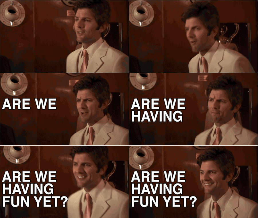
Personal Blog: Are We Having Fun Yet?

I’m not really sure where to start. Already it’s been such a rollercoaster of emotions. Excitement, fear, gratitude, overwhelmingness (I didn’t know this was already a word until just looking it up now). This project is so different and so much more than I initially envisioned, and that’s so great. But what IS it? There’s a lot of discovery yet to happen, and I’m getting caught up in worrying that we don’t have enough time for it to happen. I know that’s not the best mindset, but I also know I’ll get over it as we get into a groove.

From last semester, I already know I’ve learned so much–heck, even from last week I’ve learned so much. I need to remember this.

And I need to remember to trust my team and the amazing skills they’re bringing to our project. (Huge shout out to Asma, Lane, Nadia, and Lisa!) It’s not like high school where one person is doing all of the work (me, and I’m guessing each of my team members were also that person too). If anything I’m maybe overly concerned I’m not doing enough because I don’t want to let any of them down. Are we all feeling this?

I was so nervous reaching out to potential outside collaborators, and it was so exciting when it seemed like it might work out. Maybe it still could, but I doubt it. And I get it! Looking back at my initial proposal from last semester I was definitely too excited about other people’s work to really think about how I could be contributing to the field in my own way. Definitely a valuable lesson here.

Back to my initial fears about what our project will actually be, I’m looking at Lisa Rhody’s ProjectLab, in particular the section on audience: “You are an audience.” I am part of the audience. What do I want to build and use? I’ve tried to think about care and how we can use this project to care for the dead, but I don’t want to forget about care for the living–and for the living people trying to create it. What do I want? After being cooped up in a studio apartment for almost a year, I want something FUN. I want a tool that can build meaning, but is also something that is fun to use. And I want to have fun creating it.